07 December 2020
Mapping Irish hedgerows

Hedgerows are the most common habitat on lowland farms in Ireland – a characteristic feature of the Irish countryside. Teagasc use earth observation technologies to map the Irish agri-environment. One of the main targets over the years has been hedgerows. Catherine Keena and Stuart Green explain
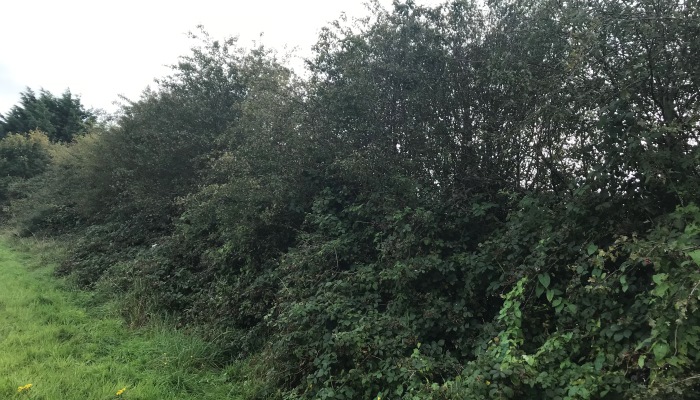
Hedgerows encompass many different forms, shapes and sizes.
Earth Observation Technologies
Teagasc use earth observation technologies such as satellites, drones and Geographic Information Systems or GIS to map the Irish agri-environment. One of the main targets over the years has been hedgerows. The extent and condition of hedgerows is mapped using satellites and aerial photographs. Technologies like laser scanning and drones are used to get characteristics of individual hedgerows.
There are an estimated 689,000 kms of hedgerow in the country using a very broad definition of hedgerow which includes all woody vegetation growing on a boundary from stockproof hedgerows to relict hedgerows. Hedgerow length varies across the country. Counties around the midlands and the border tend to have the highest density of hedgerows with smaller fields. Cavan has the highest length of hedgerows per hectare. Counties on the western seaboard have the lowest percentage because they have areas of open upland that isn’t enclosed. Also counties like Donegal and Galway have a lot of stonewalls rather than hedgerows.
Technologies used to map hedgerows including satellites and aerial photography look down from above, giving the footprint and extent. Hedgerow volume is also of interest. As hedgerows are three dimensional (3D), height and width are needed in addition to length. Technologies like laser scanning and drones give a 3D model, from which biomass can be determined and used for assessing hedgerows for the sequestration of carbon.
For further information on hedgerow maps and other agri-environment maps, see the Teagasc Map of the Month series on https://www.teagasc.ie/rural-economy/rural-economy/spatial-analysis/gis-monthly-maps/
BRIAR: Biomass Retrieval in Ireland using Active Remote sensing Authors: Stuart Green, Shafique Martin, Saeid Gharechelou, Fiona Cawkwell and Kevin Black. EPA Research Report No. 305 https://www.epa.ie/pubs/reports/research/climate/Research_Report_305.pdf
To see all of the activity of Hedgerow Week follow this link https://www.teagasc.ie/environment/biodiversity–countryside/farmland-habitats/hedgerows/
