20 October 2023
Using yield maps to make better decisions in the future
Farming just outside Enniscorthy, Co. Wexford, Don Somers, a Teagasc Signpost tillage farmer, is using all the precision tools available to him to boost profitability.
Starting off his journey in precision farming involved the purchase of an auto-steer kit, which also had the ability to monitor yields and produce yield maps.
“I decided to fit this to the combine to make harvesting easier,” Don told Teagasc’s Michael Hennessy and Dermot Forristal on a recent episode of the Tillage Edge Podcast.
“It then made sense to set it up with the sensor necessary to record yields. At the time I didn’t see myself using it, but I did know that you need to keep several years of yield maps in advance to make proper management decisions, you can’t just go off one year’s data. With 3-4 years data I knew I would have something useful,” Don explained.
Yield maps are hugely valuable and they provide a history of crops and how different fields perform, Don provided an overview of how this technology collects data.
“On the harvester, there is a position sensor and GPS receiver. An optical sensor was fitted to the clean grain elevator, and the yield module interprets the yield from this sensor at every point in the field using the GPS, and this in turn produces a map of the variation in the field.”
When purchasing the technology Don opted for the retro-fit option. This provides him with the flexibility to move the technology to another combine, while still retaining all of the previous data. This has also created flexibility in that he doesn’t have to stick to one machinery brand when it comes to replacing the combine harvester on his farm.
On the use of the auto-steer kit, Don explained: “It’s very simple to use. If you can use a smart phone you can use this. It’s a touchscreen system.
“When I drive into a field, I select the field. All my fields are in the system. I select the crop I am cutting and I start cutting. In the first piece cut in each field, I weigh the first trailer. This is important to confirm that the weight in the trailer is the same as that recorded on the screen.
“If not, I can do an adjustment on screen to calibrate the optical sensor. Every field I go into, I select the field and the crop type and it works away in the background. After harvest I download my data onto a USB stick and upload the data to the software programme that can interpret the data and create the yield maps.”
Making use of yield maps
Noting the importance of reliable data, Don said: “Once you start to build up a number of years, three years would be the minimum, you can start to look at why particular parts of the field are not yielding well and other parts have yielded particularly well.
“To assess this properly, we did soil samples based on the yield maps. Traditionally, we would have split a field in two, soil sampled one side of the line and the other side, but with this system we were able to divide up fields based on yield.
“This allowed us to see what the problem was in the low yielding parts of the field. Was it a pH issue, a P or K issue or was it a wet part of field, or shaded etc? What we were looking for is patterns. We could then use that information to decide if a nutrient was short, or if it was a pH problem or soil issue – in field precision, rather than across the farm.
“With the soil tests we found most fields were pretty good but for the fields that were very variable, we were able to do variable rate application of P fertiliser which was low. We actually saw bigger variation in pH than nutrients, but unfortunately I don’t have a spreader capable of doing variable rate application of lime and can’t find a contractor with a machine capable of variable rate lime spreading. But I would hope that’s the next step on this farm to do variable rate lime spreading.”
Dermot Forristal, Teagasc Researcher in Crop Mechanisation, explained: “It’s important to remember that yield maps may show you some variability that you can’t do much about e.g. lighter soils in a dry year which you cannot do much about.
“Management response for those will be low; but it’s important to also look at the soils in those areas – for example for soil texture and other physical soil problems, not just lab analysis. Is there other things can be done about maybe soil structure?”
Concluding on the use of yield maps, Don said: “The more yield maps I have the better. We remember the very good years and the very bad years, but over 10, 15 or 20 years it will be easier to target what worked in certain years and what didn’t work in other years to make better decisions in the future.”
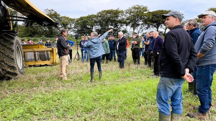
Don Somers was the host of a recent Signpost Programme tillage event, from which a number of Teagasc Tillage Edge podcasts were recorded. Listen to these podcasts below:
How this Wexford farmer is getting the best from precision machinery:
Getting the best from cover crops and organic manures on Don Somers’ farm
Soil management on Don Somers’ farm
This article has been published as part of Teagasc Signpost Sustainability Month. For more information on the activities planned, click here. To learn more about the Teagasc Signpost Programme and its ambitions, click here.